AZ/AZ, 2017.
Printed text on Canson paper 224 g/m².
150 × 100 cm (59 × 39 in) each.
Solo exhibition Travelers and Strangers,
Kentler International Drawing Space, New York, 2017.
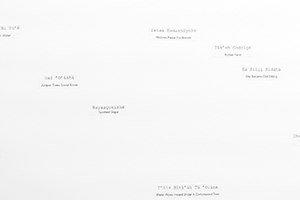
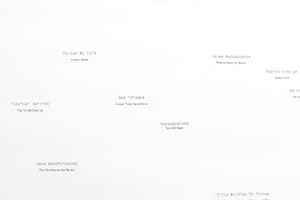
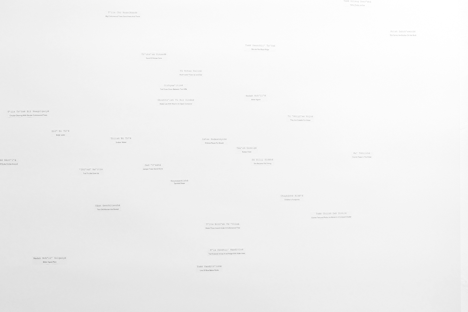
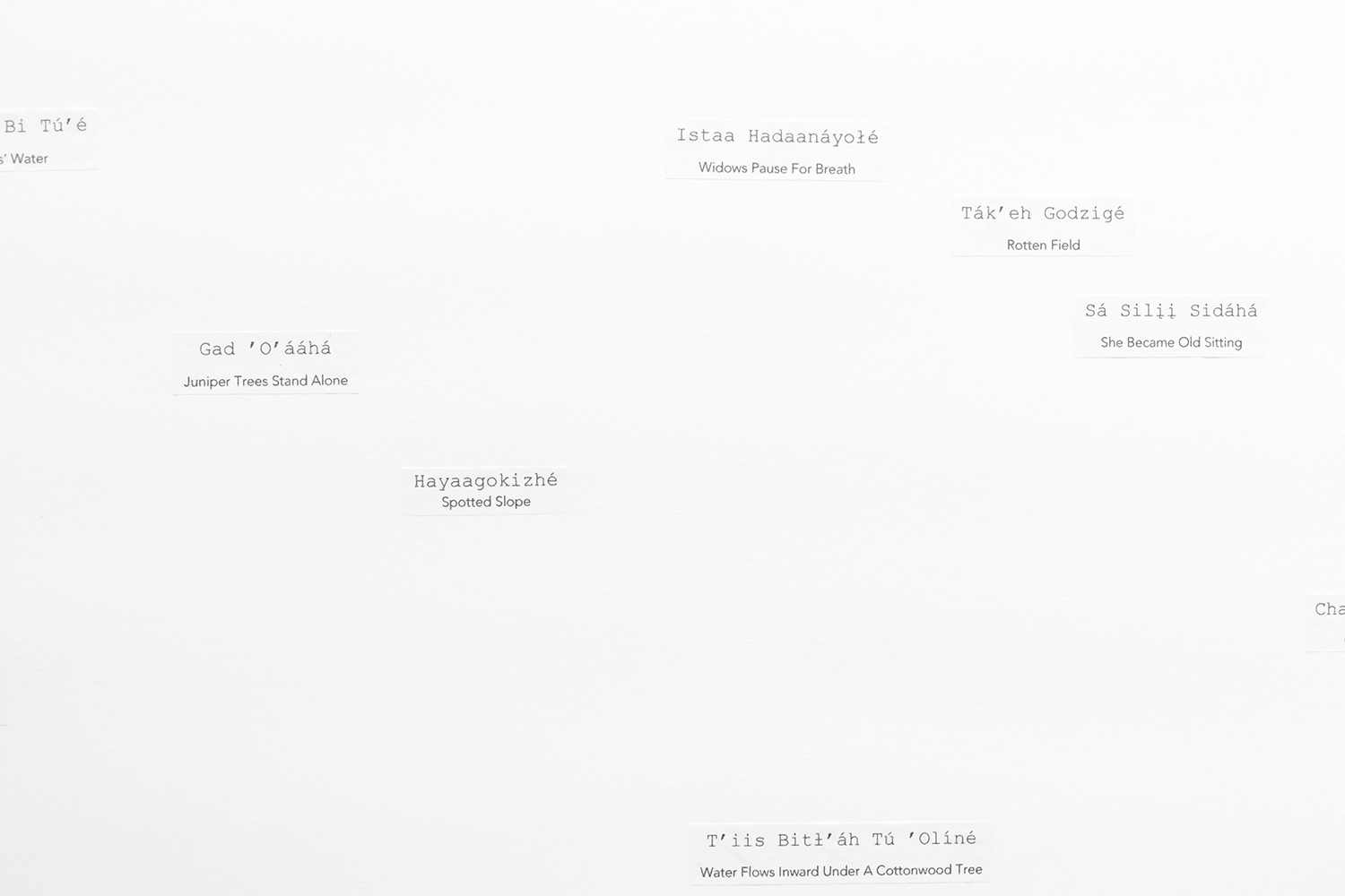
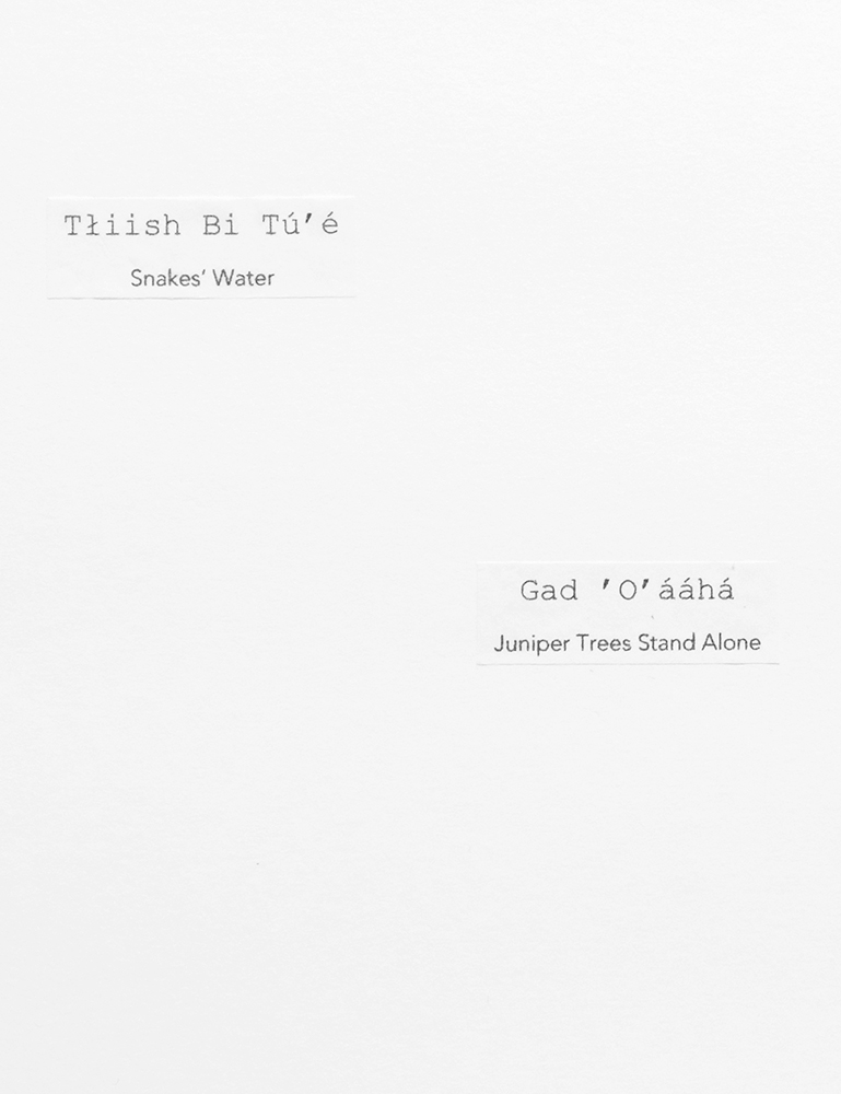
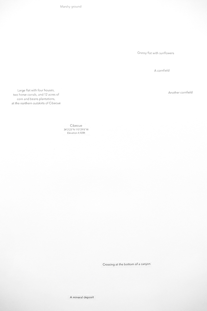
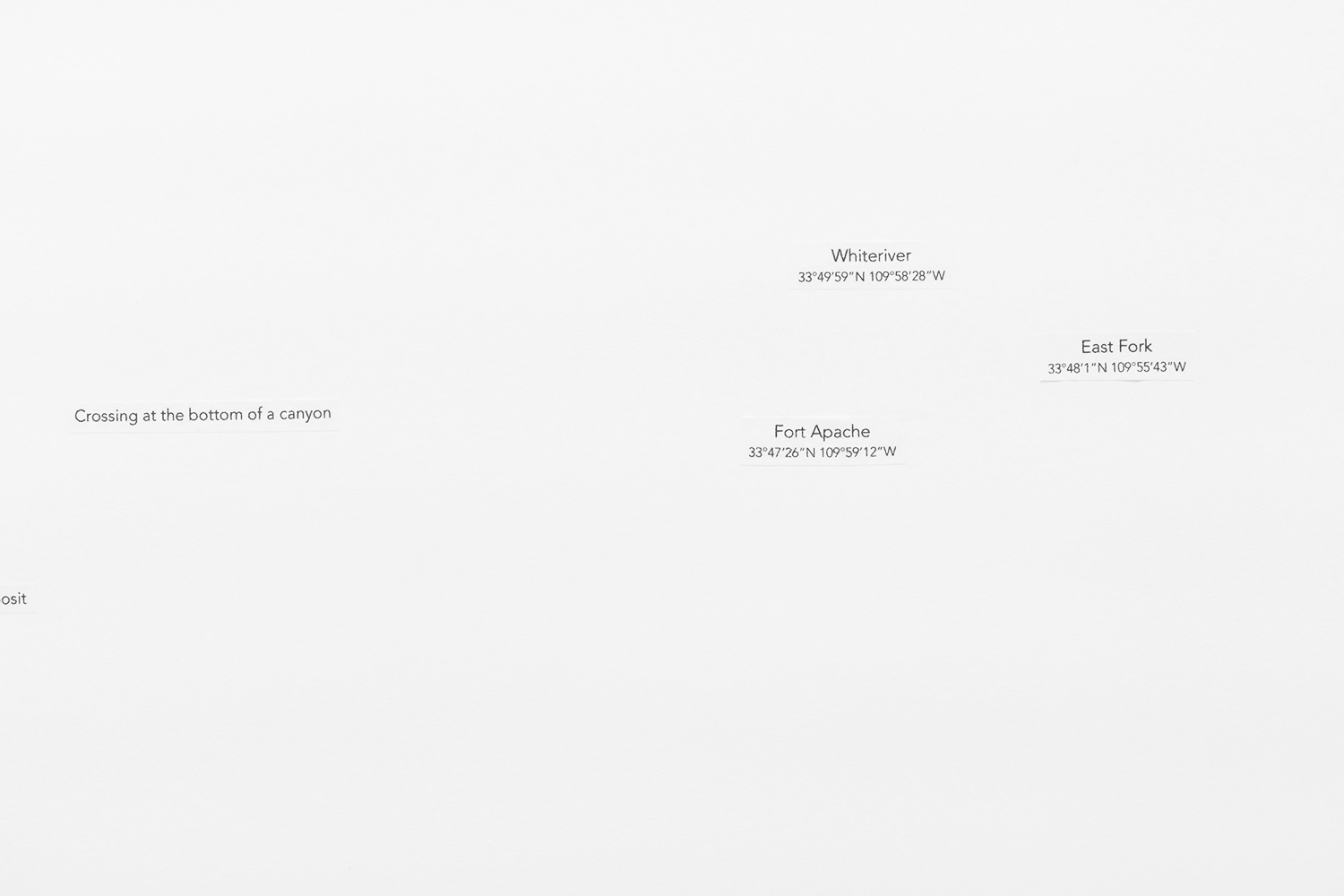
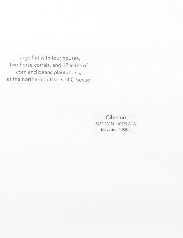
The anthropologist Keith H. Basso worked in the Cibecue region with the Western Apache, who shared with him the toponyms of places they visited together as well as their historical and spiritual meaning. These toponyms are so descriptive that they are sufficient to evoke the landscape (drawing on the left). These same places are named differently on road maps (drawing on the right).
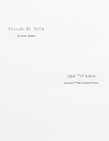
Drawing, left (AZ): Apaches toponyms in the Fort Apache region, Arizona. Gad ‘O’ááhá (Juniper Tree Stands Alone) corresponds to Cibecue on road maps.
Drawing, right (AZ): Fort Apache region, Arizona after a road map. Cibecue corresponds to the Apache toponym Gad ‘O’ááhá (Juniper Tree Stands Alone).


AZ/AZ

AZ
Apache toponyms of the
Fort Apache region, Arizona.
AZ
Apache toponyms, detail.
AZ
Apache toponyms, detail.

AZ
Gad ‘O’ááhá corresponds to
Cibecue on a road map.
AZ
Gad ‘O’ááhá corresponds to
Cibecue on a road map.

AZ
Fort Apache region, Arizona,
after road maps.
AZ
Fort Apache region, detail.
AZ
Fort Apache region, detail.
AZ
Cibecue corresponds to the
Apache toponym Gad ‘O’ááhá.